Canada Map

Request Free Visitor Guides

Presidential Range Tour

Basics
Length:
115 miles (185 km)

Description

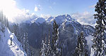
This byway's stunning singularity is the Presidential Range.This range (part of the White Mountains,) serves as a backdrop attimes, and at other times, looms as you round curves (as on route2). Pinkham Notch, a high mountain pass, elicits even more natural spectacle.

The Presidentials cradle cozy New England villages and pedestal the Wildcat Mt. Ski Area.

On a clear day you can see the smoke rising from the Cog Railway as it heads up the western side of Mt. Washington.

Details

Length:
115 miles (185 km)
Main Roads:
US-2 E and US-302 W

Map + Directions

Customizable Directions


Copyright © 1997 - 2024 The Go Travel Sites. All Rights Reserved and.

Email Page Link

Complete the form below to email this page to a friend or family member's email. You can send yourself an email as well. Your email and your recipient's email will NOT be shared with anyone. See our full Privacy Policy for details.
:
:
:


:
Copy Yourself on the Email Yes No
:
:

1

Select a Free Visitor Guide below

2

Complete the form to receive your guides by mail
Bellingham Whatcom County Bellingham Whatcom County Bellingham Whatcom County
Canadian BorderWe offer a break from the ordinary. With magnificent natural scenery, skiing and snowboarding at Mt. Baker, hiking, arts and theatre, charming villages and water adventures like whale watching – Bellingham Whatcom County is a unique area of Washington state. Visit our website to plan your trip.
Request this Free Visitor GuideRequested! You're all set! Complete the form below to receive your guides by mail.